Showing posts with label maps. Show all posts

Monday, June 21, 2010

When East Is West, and West Is East, and Ever the Twain Shall Meet

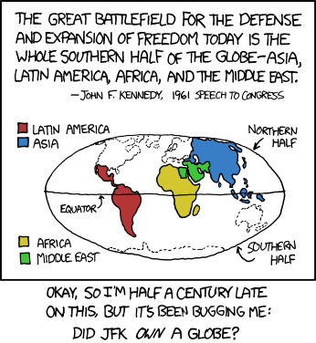
The current xkcd comic raises an interesting question.


http://xkcd.com/753/

{Not that the non-JFKs among us are immune from this sort of thing. In the US alone:

+Large portions of West Virginia are actually east of much of Virginia, and some parts of Virginia are west-er than any part of "West" Virginia.

+Spartanburg, South Carolina is north of Wilmington, NORTH Carolina.

+The East River flows south as it makes its way through New York City, and the easternmost point in the continental US is called, what else, West Quoddy Head.

+South Bend is in extreme northern Indiana, West Bend a long way from anything we might call "western" Wisconsin, and for the fun of it I'll throw in the fact that Jo Daviess County in the northwestern corner of Illinois is traditionally lumped in with Carbondale, Decatur, and Cairo as part of the region known as "Downstate."

Okay, okay, I know there are reasons for all these names, North Carolina is (mostly) north of South Carolina, the East River is east (of Manhattan), Downstate Illinois basically means not-Chicago, yeah, yeah, yeah, what-ever. I still say we need truth in advertising. What's west should never be east, and what's down should not be up, and it should be possible to distinguish north from south easily and quickly and confidently. The spatial reasoning skills of our youngsters are at stake! Won't someone please think of the children?}

Tuesday, August 4, 2009

SummerMath, Part 4: On the Road Again

If you're like most Americans, you and your children spend a lot of time on the road. There are plenty of ways for kids to pass the time on car trips, whether of 5 minutes or 500 miles. Several of them I'm quite sure you know:

Screaming "She's on MYYYY side!!!! Mom, make her get off of MYYYY side!"

Asking as often as possible, "Are we there yet?"

Threatening to throw up.

Singing vaguely risque songs like "The boys and girls are kissing in the D-R-A-K, D-R-A-K, D-R-A-K, Dark!"

Singing "George Washington Bridge." OH MY EARS QUICK RINSE THEM OUT WITH RUBBING ALCOHOL (George Washington Bridge, for those of you not in the know, repeats the lyrics "George Washington Bridge" again and again and again to an essentially unmelodic melody. My sister pulled this one on a 5-hour car ride between Chicago and La Crosse, Wisconsin, many years ago, and when she was finally told she could NO LONGER sing "George Washington Bridge" she said "Okay, then I will sing 'Adobe Bricks.' 'Adobe Bricks,' as it turns out, is 10 times worse. We eventually threw her out of the car)

But those days are over, for here is a list of WONDERFUL MATH ACTIVITIES that you can do in the car. (Assuming that your children can actually see out the windows.)

1. LICENSE PLATES. In New York State, most (not all) plates are of the form AAA 1111--three letters, then four numbers. Have kids hunt for license plates withe certain characteristics. Who can find one that has four even digits? Four odd digits? Four digits that are ascending (like 4689)? Descending (say, 8521)? Two digits that are the same? Three digits that are the same? If you're stuck at a stoplight, ask your child to add the four digits on the license plate of the vehicle in front of you--which two are best to add first? What shortcuts can your child find? (To add 6364, kids might start with 6+6=12, a "doubles fact," or with the "ten-friends" fact that 6+4=10.) Estimate by looking if the sum will be greater than or less than 20. Then check. Whoops, green light--better move on...

2. STOPLIGHTS. How many stoplights do you think there will be between here and the mall/camp/Grandma's house? Let's keep track. Will they mostly be green when we get to them, or red? You count the red ones, I'll count the green ones. Do you think it'll be about the same on the way back, or will it be different? Let's find out. For a route you drive frequently, choose a couple of lights and keep track of whether they're red or green over a period of 8-10 days. These are exercises in counting; they also ask kids to gather, use, and interpret data. More than half of the lights are green? Why do you think that might be?...That light where we cross Route 55 is almost always red when we get there--how come?

3. VROOM, VROOM. On a 4-lane highway, have kids count the cars you pass and the cars that pass you. Make this an exercise in counting forwards and backwards: start with a score of 10, add one for every car you pass, subtract one for every car that passes you. Or, start with 50 or even 100. Try not to give in to your children's pleadings to do whatever it takes to avoid being passed by that in-your-face Oldsmobile or to overtake that weirdly painted appliance truck. Does it matter who's driving?...why yes, yes, it might. (And can we correlate that with speeding tickets received? Why yes, yes, we can...)

4. NUMBERS ON SIGNS. There are lots of these running around the roads: speed limits, mileage markers, route numbers, distances to upcoming cities. We call Route 376 "route three-seventy-six," but what's its "proper" name? (Three hundred seventy-six. Yes, I know it isn't *really* a number, because it doesn't indicate three hundred seventy-six of anything...) Who can find a two-digit number on a road sign? A three-digit number? An odd number? The sign tells how many miles to Montreal and how many to Buffalo. Which is further away from us right now? How do you know?

5. MENTAL ARITHMETIC. We're at milepost 27--look, there's the sign. What milepost will we pass in five miles? Ten miles? (Careful--are we driving towards milepost 0 or away from it?) How many more miles till milepost 40? (See above.) The sign says Albany is 65 miles away. Our speed is, guess what, 65 miles per hour. About how long till we're in Albany? (Only use easy numbers for this kind of question!) The car can be a good place to go over basic facts as well: "7 + 2." "9!" "Tell me two ways to make 10." "Um--"

6. MAPS and DIRECTIONS. Have children direct you to a location they've visited many times before. Ask them to tell you where to go straight and where to turn, and whether you should go left or right when you turn. Obviously, don't break any traffic laws--you are still the captain of the ship! As for maps: Print out a map showing your route to a (relatively) nearby place. Go over the map with your child before you leave. Have your child hold the map and try to track your position along the route as you drive. Try using a road map for longer distances: Find a long thick blue line with a shield and the number 84. That's the road we're on now. We're heading west...which way is west? Can you find a city called Middletown? Excellent--we're just a little bit west of that right now. What's the next town you see? Some third and fourth graders can become quite good at navigating. Just be sure that the "road" they're having you follow isn't just a marmalade stain on the map (this happened once to Paddington Brown and his family, I believe).

As always, these are ideas, nothing more; you can come up with others yourself. Be sure not to push too hard. REPEAT: BE SURE NOT TO PUSH TOO HARD. If you find you're suddenly more invested in these activities than the kids are, cut the games short and do something else: talk, sing, tell jokes, look at scenery. But if people start yelling about siblings being on theirrrrr side, it helps to have games like find-a-license-plate-with-4-odd-digits in your back pocket; and if you can find the right combination of math activities for the car ride on any given day, you will NEVER EVER EVER have to put up with anybody singing George Washington Bridge, and that will make any hardship worthwhile.

My Heart's in the Heartland

A cool map for you geography geeks out there:


http://strangemaps.wordpress.com/2009/07/27/402-homeland-is-where-the-heartland-is/#comments

Note that some of the sizes are a bit off. Also, something seems to have happened to Dutchess County. STILL!

Monday, June 8, 2009

37 Cities, 32 States, and Lord Knows How Many Unnecessary Miles

Cheerful Charlie's Tour of the USA is at an end. Between early October and early June he visited, as the title says, 32 states plus the District of Columbia and a total of 37 cities--large ones like San Diego and Seattle, Minneapolis and Houston; smaller ones like Cedar Rapids, Iowa and Springfield, Massachusetts; and small ones indeed such as Wall, South Dakota and Virginia City, Nevada. The students got used to enormous cross-country jumps and routes without rhyme or reason--just excess mileage and wasted gas. Still, they dutifully marked in the origin of each postcard he sent, used concepts of scale and ratio to estimate the distance from one city to the next, and made helpful suggestions about ways to improve his efficiency.

We are still calculating the total mileage. But it ain't gonna be pretty.

Here is the Official T-Shirt of Cheerful's travels. Please note that the list of cities should be quite accurate, as Cheerful sent me his list for proofreading (and boy oh boy did it need it). He did NOT tell me, however, that he was going to include the three lines at the top, so I had no opportunity to do the proofing. The mistakes--OF COURSE--are his and his alone.


You can click on the image for a closer look...

Sunday, May 3, 2009

George's Excellent Adventure

Sometimes the best lessons are the ones you don't plan.

Friday morning, Ellen poked her head into the office as I was preparing for a fraction lesson with the 1-2s. "Elizabeth found a Where's George dollar in her lunch money," she said. "Okay if we take a few minutes to enter it at the beginning of math time today?"

Where's George, I should explain, is a lovely internet project that tracks paper money as it moves across the country (www.wheresgeorge.com). Since the 3-4 classes handle lots of money in their capacity as Pizza People, they occasionally run into Where's George bills, which are recognizable by special markings. We log onto the site, enter the bill's serial number, note our location, and press Enter. If the sound on my laptop is turned on, we'll then hear a cash register noise and the bill's previous location(s) will appear. Most of the bills we've found thus far have come from nearby places such as Pennsylvania and Massachusetts, Brooklyn and Kingston, but we've had bills from Missouri, Tennessee, and Texas as well. It's fun, and suspenseful, and teaches a bit about geography--and you never know when someone will find "our" bill and put it in again.

When we entered Elizabeth's bill, the screen showed that the bill was now 1128 miles from its original location. I had a sudden brainstorm. Instead of scrolling down and telling the class where the bill had come from, I'd have them narrow the possibilities by using math--specifically, their measuring and estimation skills. They'd been working on maps all year long, after all, filling in states that Cheerful Charlie had visited in his round-the-US tour. Ellen got one of the students' maps, and we hung it up. We determined that 1128 was very close to 1100, in double-round numbers, and at 200 miles to the inch, the class quickly calculated that the starting point was about 5.5 inches away from us.

It was clear to most of the students that the possibilities would form the arc of a circle, and so we did a little measuring. We ended up with a curve beginning at the western end of Michigan's Upper Peninsula and then zagging through Wisconsin, Minnesota, Iowa, Missouri, Arkansas, and Mississippi--all of them marked on the students' maps--before catching a piece of south-central Florida and disappearing over the Atlantic Ocean. "Why can't the bill have started here?" I asked, indicating where the arc crossed the Gulf of Mexico. That was obvious. "It's too wet for money in the ocean," a third grader answered (unless, he added, there were islands he "didn't know about"). As for why we didn't go north of Michigan, that was obvious too: Canada has its own money.

I scrolled down on the webpage and revealed the answer: the bill had originated in Florida. ("I knew it!" half the class exclaimed.) I named the town, which I'd never heard of. But Ellen had: her brother lived there. She asked if there was any way to find out who started the bill on its travels. Well, yes, there was; I clicked on the profile button and found a first name, Bob.

It wasn't Ellen's brother. But that was all right. Bob had provided us with a nice map of the US, each state filled in with one of six colors. Now I had my second brainstorm. We'd done a little real-life estimating and measuring with scale; it was time for some real-world data analysis.

"What do you think this map shows?" I asked, turning the computer so the students could see. Temperatures, guessed one boy. Good thought, but no. How many people live in each state? asked a girl. Close, I said. Think about what website this is, Ellen suggested, and suddenly hands were flying up all over the meeting area. Bob, they realized, had marked dozens and dozens of bills and sent them into the wild. The colors showed how many of those bills had turned up in each state.


[Here is Bob's Hit Map, by the way:]

Right on the money! (So to speak.) The only question now was which colors stood for the most bills and which for the fewest. To help, I had them identify a few key states on Bob's map, and then I gave them a little extra information. California, I explained, had the most people of any state. Texas, New York, and Florida were next. Wyoming took up a lot of space, but it had fewer people than any other state.

Working as a group, the class swiftly came up with a sensible schematic for the colors. Red, the color of Florida, California, and New York, would be the most. Bright green, it seemed apparent, would be next, judging from what the children knew of population and distance, and so on, down to lowly Wyoming, the only state that was colored gray.

The guesses were in. It was now time for the Great Unveiling. I had everyone's full attention: they were deeply invested in the outcome by now. And the results were entirely satisfactory. The class had four out of six colors right; the only error had been reversing the orderof the fourth- and fifth-most colors.

Not bad, not bad at all, I told them, and we moved on to the regularly scheduled lesson on division.